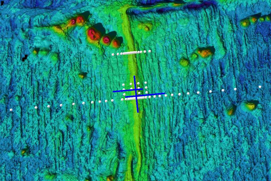
Local bathymetry and deployment locations
(white spheres) of the 69 deployment sites. The northern
has sites to +- 20 km from the ridge axis and the southern
line has sites +-100 km from the ridge axis. Blue lines show
the location
of the controlled-source EM transmitter tows (about 80 km of
total tows):