Hydrate
Ridge EXperiment 2004 (HyREX04)
In August 2004, the Marine EM Lab conducted a 25 site CSEM,
MT and CSMT survey at Hydrate Ridge, offshore Oregon in order
to asses the capabilities of the marine controlled-source
electromagnetic method for in situ characterization of gas
hydrates and gas hydrate bearing sediments. Karen
Weitemeyer used these data for her PhD project,
funded by the Seafloor
Electromagnetic Methods Consortium.
Publications (Click to
download):
HyREX04 Cruise Report,
PDF (1.5 MB).
K. Weitemeyer,
S. Constable, K. Key,
and J. Behrens. First results from a marine controlled-source
electromagnetic survey to detect gas hydrates offshore Oregon.
Geophysical Research Letters, 33(L03304), 2006. (PDF,
700 KB).
K. Weitemeyer,
S. Constable, and K. Key.
Marine EM techniques for gas-hydrate detection and hazard mitigation.
The Leading Edge, 25(5) 629-632. 2006. (PDF,
424 KB).
Karen Weitemeyer, Guozhong Gao, Steven Constable, and David Alumbaugh,
First results from a marine controlled-source
electromagnetic survey to detect gas hydrates offshore Oregon.
Geophysics, in press (PDF,
12.8 MB).
Data used in the inversion shown in this paper can be downloaded in DIPOLE1D format:
In UTM coordinates.
In model coordinates. (The data format is described HERE)
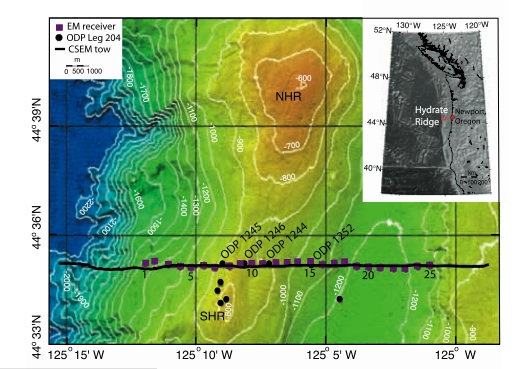
Bathymetric map of survey area at southern Hydrate
Ridge (SHR) (from MBARI multibeam survey,
2001). Inset shows regional location (ETOPO2 global relief
from NOAA, 2001). NHR, northern Hydrate Ridge.
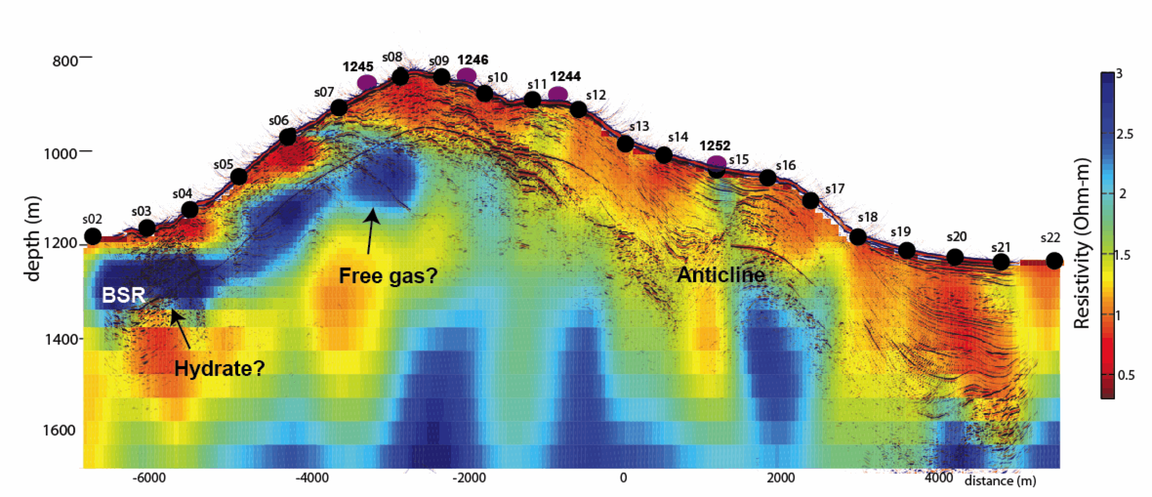
2D inversion of radial 5Hz CSEM data from Hydrate Ridge experiment. From Weitemeyer, Guozhong, Constable, and Alumbaugh, 2010, in press.
Seismic data courtesy Anne Trehu, Oregon State University.
|

